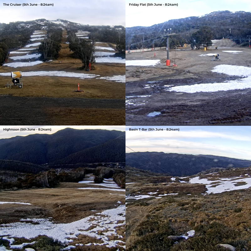
With less than five nights until the proposed opening date for many of Australia’s ski resorts, the latest webcam images and upcoming weather forecast from the slopes of New South Wales and Victoria are worrying for snowsports enthusiasts.
Currently all major ski resorts across the country are planning to open on the same date, coinciding with the long weekend due to the King’s Birthday (12th June), a public holiday observed by all states except Queensland and Western Australia.
| Resort | Planned opening date 2023 |
| Perisher (NSW) | Saturday 10th June |
| Thredbo (NSW) | Saturday 10th June |
| Charlotte Pass (NSW) | Saturday 10th June |
| Selwyn Snow Resort (NSW) | Saturday 10th June |
| Mt Buller (VIC) | Saturday 10th June |
| Mt Hotham (VIC) | Saturday 10th June |
| Falls Creek (VIC) | Saturday 10th June |
Last year, Australian ski resorts were blessed with impressive early season snowfall after a polar front brought cold weather and snow, with many major ski resorts such as New South Wales’ Perisher opening on June 4th. The Queen’s Birthday (prior to Queen Elizabeth’s death) also fell slightly later (13th June), giving resorts even more time to prepare for the busy weekend visitation.
After several seasons of disruption due to COVID-19 all resorts are hoping for a stellar start to winter, but none so much as Selwyn Snow Resort, which plans to open for the first time since its infrastructure was destroyed in the Black Summer bushfires of 2019-2020.
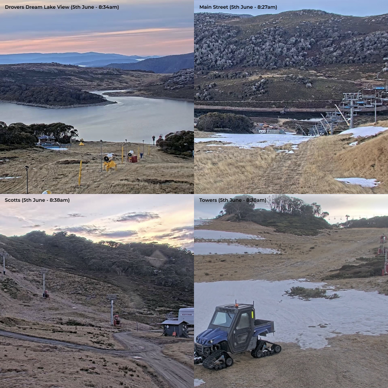
The latest snow cam imagery
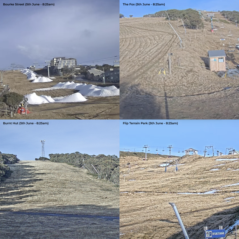
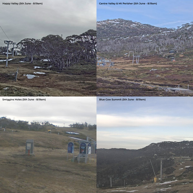
Below are a series of webcam images taken today (5th of June 2023) from some of the largest resorts in the country captured and collated by the team at Snow Season Central. While some areas of the mountain would not expect to be snow covered at this stage of the season, there is a general lack of snow in all parts of the resorts.
Whats in the snow forecast?
According to Snow Forecast, one of the leading providers of resort specific weather and snowfall forecasts, there are also challenges ahead. Many of the resorts are forecasted for significant rainfall on Wednesday and Thursday this week, with mid-mountain temperatures as high as 7 degrees centigrade, this may cause any snow that has accumulated to melt faster.
The forecast for Mt Buller (below) is relatively similar, with rain arriving in the middle of the week, and mid-mountain temperature going as high as 8°C. There is a small amount of snow forecasted for the following week, but then temperatures are set to climb as high as 5°C on Friday 16th June.
“In the last few years we’ve seen varied early season conditions globally” said Edwyn Raine of Snow Season Central. “Austria in Europe had a particularly slow start to winter with barren pistes in late December, while many North American resorts, such as Mammoth Mountain, California, have experienced record breaking annual snowfalls. Unfortunately, this is just a sign of the times and we can only hope more snow is around the corner!”
How are early season conditions looking in New Zealand?
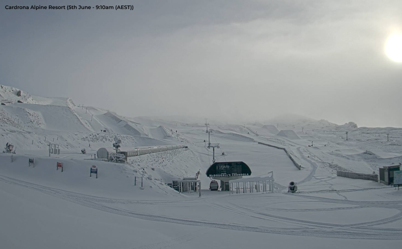
While Australian ski resorts appear to be having a slow start to winter, much of New Zealand has seen good early season snowfall. Below is a photo from the 5th June at Cardrona Alpine Resort located nearby to the ski town of Wanaka where snow appears to be plentiful.
For the resorts of Central Otago in the South Island there is not much snow in the immediate forecast, but temperatures are to remain fairly cold without rainfall.


